Topographic
Advertisement
AutoDEM
AutoDEM (aka as AutoMNT) is a freeware GIS software to create Digital Elevation Models (DEM) from scanned topographic maps for Windows. Through different data layers (map, contours, DEM, etc.
Advertisement
New Mexico Topo Map v.1 50
The purpose of this venture is to create a detailed topographic map of the entire state of New Mexico at 24k detail. This map is created for Garmin GPS receivers and Mapsource.
Florida Topo Map v.1 60
The purpose of this venture is to create a detailed topographic map of the entire state of Florida at 24k detail. This map is created for Garmin GPS receivers and Mapsource.
Jisio Network Designer v.1.0
The goal is to get a logic and a topographic view on the network. The prototype Jisio (OBST Network Visualization based on platform independent Java) can collect GPS-data to generate a map of your network area.
MT Topo - Public Lands v.2 1
This mapset contains topographic, hydro, road, trail, POI, and public land data for the state of Montana. Topo lines dissipate quicker as zoom scale increases. Much improved over the Garmin 24K series when zoomed out.
TerraViewer v.1.1
TerraViewer makes use of Microsofts free TerraService web service to retrieve and display archived satellite images and topographic maps of any region in the United States. You can search for regions by long/lat values or by city names.
Mapster v.1.1
Mapster is a program for creating custom topographic maps of arbitrary size for printing.
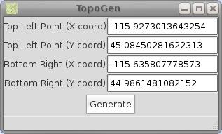
TopoGen v.0.2
TopoGen is a small PyGTK application which will make a topographic image overlay for Google Earth using the given coordinate boundaries.
WW2D v.1.0
WW2D allows you to explore Earth using satellite imagery, topographic maps and image from other data sources also providing large placenames and boundaries database and allowing you to install community-made add-ons for even more info about our plane
FreeView v.10 3
Geomatica FreeView is a flexible data viewing tool supporting over 100 raster and vector formats for loading, viewing, selection, and enhancement. FreeView is useful for any geospatial data viewing application, and is freely distributable.
Geomatica FreeView v.9. 1. 2005
Geomatica FreeView is a flexible data viewing tool supporting over 100 raster and vector formats for loading, viewing, selection, and enhancement. FreeView is useful for any geospatial data viewing application, and is freely distributable.